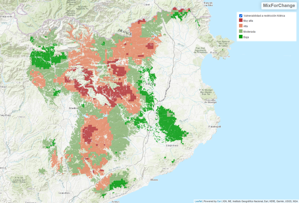
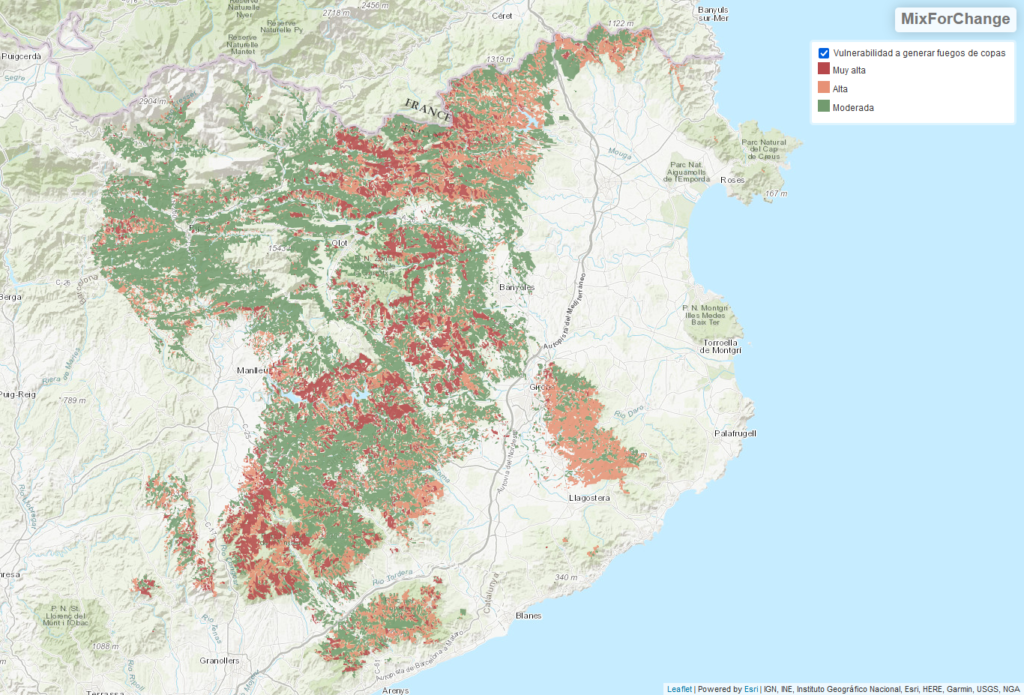
This cartography aims to show the vulnerability to climate change of the Mediterranean sub-humid mixed forests. This work has been done at the level of Catalonia, where these forests extend for circa 152,000 ha. The two main climate change related impacts in these conditions are:
-
- Water restriction: it is expresses as the comparison between the historic (1985-2015) and the projected (2020-2050) climate data, following the global model CNRN-CERFACS-CNRM-CM5, regionalized through the European model CCLM4-8-17 under the concentration scenario 4.5 (that includes the application of various climate change mitigation measures) of EU-CORDEX project (Kotlarski et al., 2014). The climate data treatment was done with the statistical package MEDFATE (de Cáceres et al, 2017), and following De Cáceres et al, (2018).
- Large forest fires: the cartography was prepared based on geo-referenced information of forest structure and fuel models, biophysical information and meteorological scenarios, and using the fire behaviour simulator FlamMap 5 (Finney, 2006).
View the map in dynamic format (page may take a few minutes to load due to the volume of information).
